

Version:
Last Updated: August 2025
Hartlepool Borough Councils biggest physical asset by far is the highway network of which periods of prolonged extreme weather can cause severe disruption and delays resulting in lost income for local and regional businesses. This was prevalent during the winters of 2013/14, where many areas of the country suffered due to the severe weather.
In response, the Secretary of State commissioned an independent national review of the resilience of the network which resulted in the 2014 Transport Resilience Review by the Department for Transport (DfT). The review made 63 recommendations; 14 of which were for Local Authorities.
The review recommended that Local Highway Authorities should identify a ‘resilient network’ which will receive priority in extreme weather – to maintain economic activity and access to key services. This has support from the Well-Managed Highways Infrastructure (a Code of Practice).
For Hartlepool Borough Council the resilient network (covering 10% of our total network) is a sub-section of the primary winter maintenance network. This gritting network consists of a number of defined routes on which we undertake precautionary salting and is much more extensive – the primary routes cover approximately 40% of our total highway network.
In identifying the resilient network the following scenarios were noted :
- Critical Services – Urban based
- Main business parks and / or industrial estates
- Emergency services
- A&E Hospital
- Public Transport key sites
- Local Authority Depot
- Critical infrastructure e.g. Nuclear Power Station
How will it be used?
The resilient network will be a tactical tool where priority can be given to minimise the impacts of extreme weather. This could include:
- extra maintenance interventions/inspections may be used to ensure continued functionality;
- prioritising funding to mitigate the onset of deterioration of the asset;
- prioritising the work programme to reduce the risk of failure in the asset;
- prioritising reactive maintenance in the case of extreme weather;
- assisting in emergency planning events including recovering from an emergency event.
Priority maintenance will not be restricted to the carriageway but will include the following key network assets –
- Carriageway
- Footway
- Structures
- Traffic Signals
- Street Lighting
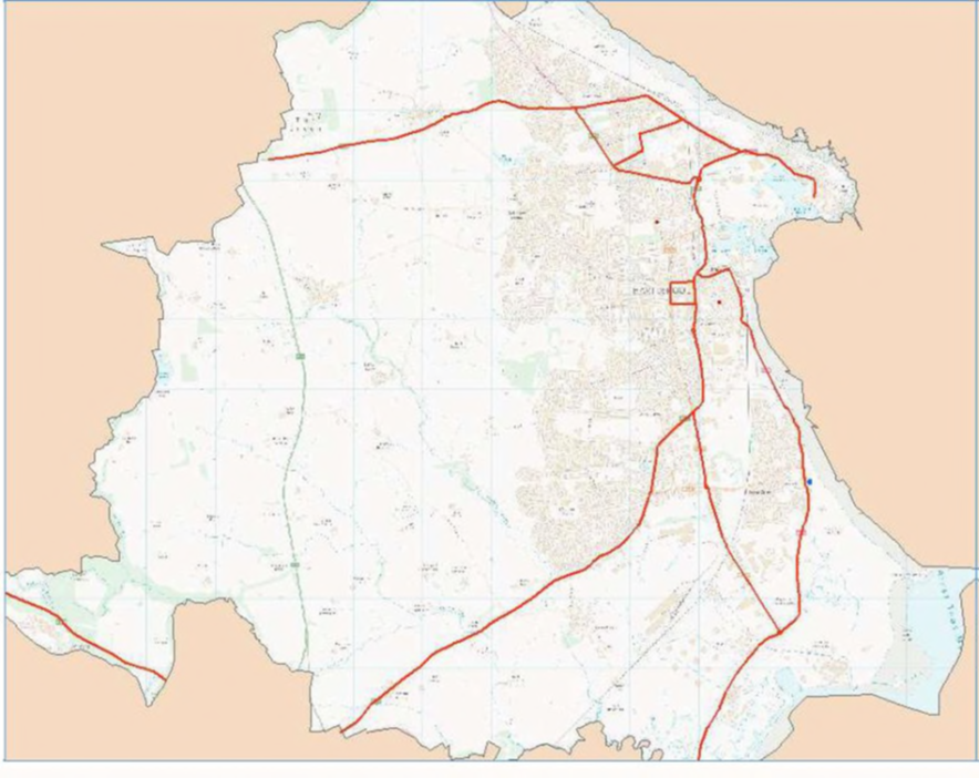
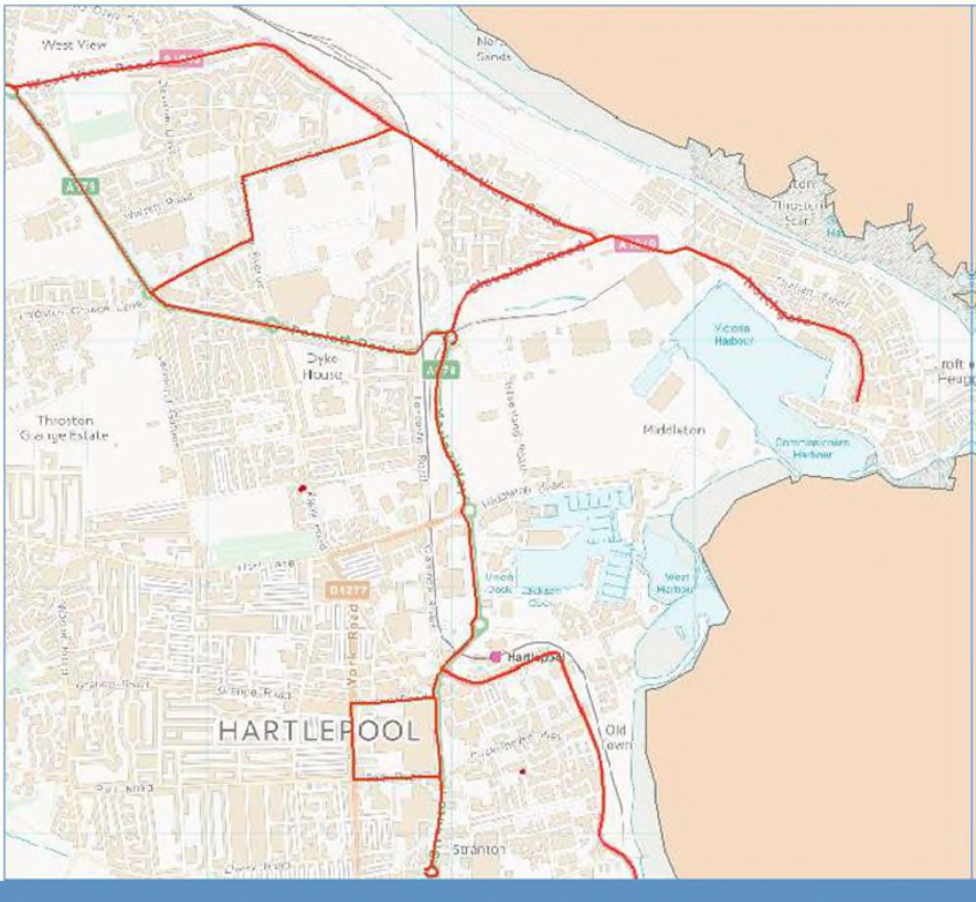
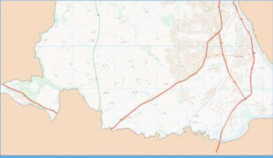
The map below shows graphically the network as a whole with further maps detailing the north and south regions in more detail.
Maps detailing Hartlepool Borough Councils resilient network
Map 1 – complete network
Map 2 – main town centre and north estates
Map 3 southern area
Highway Inspections
In the event that it deemed necessary to put into action the needs of the resilient network normal highway inspections will likely cease for a period of time and be replaced with a dedicated inspection route which will be continuously driven to ensure the primary network remains open to enable businesses and emergency vehicles to have full access. The inspection route is detailed below.
|
Street |
Location |
Length (m) |
|---|---|---|
|
Belle Vue Way |
Full length |
1866 |
|
Brenda Road |
A689 to Tees Road |
3370 |
|
Church Street |
Full length |
477 |
|
Cleveland Road |
Full length |
728 |
|
Coronation Drive |
Full length |
1577 |
|
Easington Road |
Hart Road to Powlett |
965 |
|
Hart Road |
Full length |
3483 |
|
Hartlepool Road |
Full Wynyard Village length |
2852 |
|
Holdforth Road |
Full length |
449 |
|
Mainsforth Terrace |
Church Street to Newburn Bridge |
934 |
|
Marina Way |
Full length |
1411 |
|
Northgate |
Full length |
1385 |
|
Park Road |
York Road to A689 |
350 |
|
Powlett Road |
Full length |
1267 |
|
Stockton Road |
A689 section Belle Vue Way to Wolviston roundabout |
6822 |
|
Stockton street |
Full length |
328 |
|
Stranton |
Full length |
352 |
|
Tees Road |
Full length |
4791 |
|
The Cliff |
Full length |
595 |
|
The Front |
Full length |
607 |
|
Victoria Road |
A689 to York Road |
332 |
|
Warren Road |
West View to Winterbottom |
645 |
|
West View Road |
Full length |
2591 |
|
Winterbottom Avenue |
Warren Road to Holdforth |
913 |
|
York Road |
Victoria Road to Park Road |
309 |